
West St. Paul ZIP Code Coverage
West St. Paul is commonly associated with one incorporated-city ZIP reference: 55118. Official city pages use it for City Hall, the library, and local addresses. The Minnesota Legislature place and ZIP reference also lists West St. Paul, 55118, and Dakota County. That is useful postal context, but it does not establish a city-wide boundary. The research supports one row here, not a speculative list of surrounding ZIP areas or a claim that every 55118 address falls within West St. Paul.
| ZIP Code | Areas covered | Post office | Notes |
|---|---|---|---|
| 55118 | West St. Paul is commonly referenced with this ZIP | West Saint Paul Post Office service area | USPS can use Saint Paul as the postal city; use city boundaries and Dakota County parcels for jurisdiction |
A ZIP Code is a postal delivery geography. It can cross municipal lines, and a postal city label can differ from the incorporated city. For an address question, use the ZIP as one field among several, then check the city boundary and the parcel’s legal description. That sequence is safer than assigning jurisdiction from the last line of an envelope.
West St. Paul ZIP Code Labels
The local naming quirk is clear in the USPS West Saint Paul Post Office listing. Its address is labeled Saint Paul, Minnesota 55118-2314, even though it serves the West St. Paul area. USPS postal-bulletin material also uses Saint Paul as the postal city for 55118. The mailing label therefore should not erase a West St. Paul city reference, and the city reference should not turn every 55118 address into an incorporated-city address.
The official USPS post-office details provide the postal context shown below.
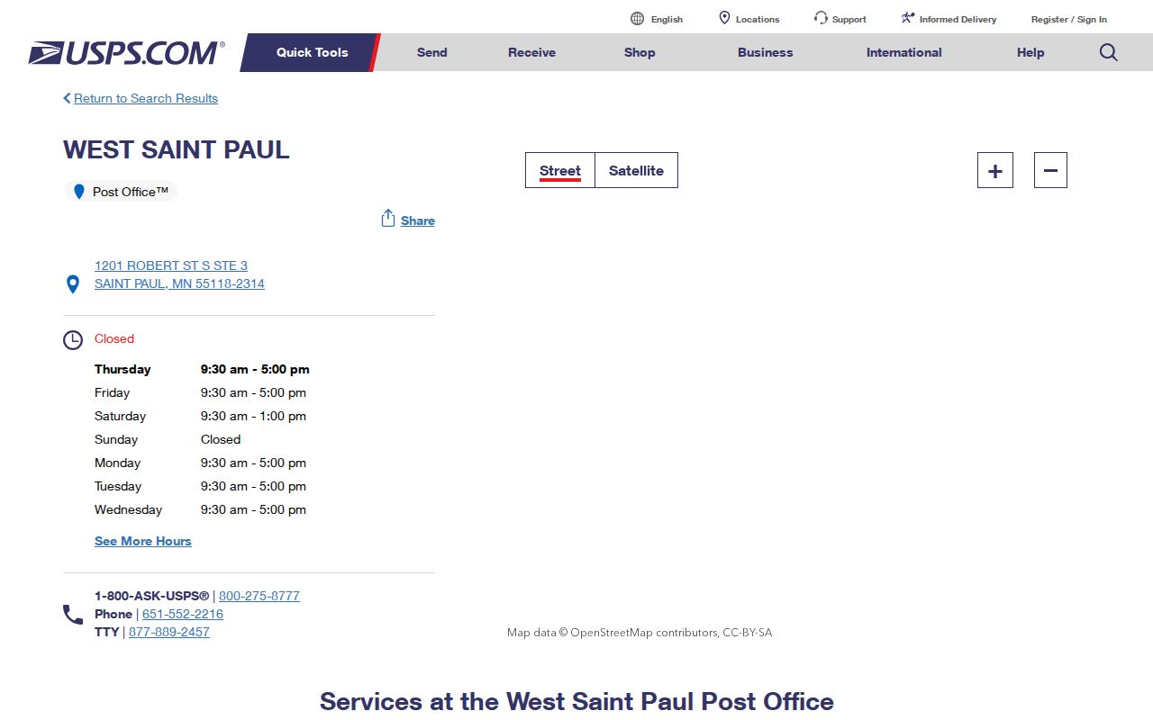
Read the city line as a delivery label, then use a dated city map or county parcel record for a municipal answer. This is the same reason a historical catalog search should test West St. Paul, West Saint Paul, and the Saint Paul postal variant.
West St. Paul ZIP Code Normalization
The USPS ZIP Lookup supports address lookup, city-and-state to ZIP lookup, and cities-by-ZIP lookup. In address mode, street, city, and state are required; company, apartment or suite, and ZIP fields are optional. A result returns a standardized postal address and ZIP or ZIP+4 information. It does not prove that a person or organization is at the address. When several results appear, include the unit information and keep the USPS-standardized form with the research notes.
| Company | Optional field in the USPS address mode. |
|---|---|
| Street | Required delivery-street field. |
| Apartment, suite, or other | Optional field that helps distinguish a specific delivery address. |
| City | Required field; compare West St. Paul, West Saint Paul, and the relevant postal label carefully. |
| State | Required field for the address-mode search. |
| ZIP and Find | ZIP is optional in address mode; the Find control returns the standardized postal result. |
ZIP+4 narrows mail delivery beyond the five-digit ZIP. It remains a delivery aid, not a city-boundary decision or evidence of occupancy. The same caution applies to a post-office address, a carrier route, and a postal city name.
Find West St. Paul by ZIP Code
A precise ZIP workflow joins postal, parcel, and city records in order. Dakota County’s free Property Information interface searches by address or Parcel ID, not by a published owner-name or ZIP-wide resident list. Its companion Dakota County Online Property Maps and Interactive GIS Map provides the mapping layer. A ZIP narrows the address question, but the parcel and map are what connect an individual address to the county’s current record geography.
- Enter the complete delivery address in USPS ZIP Lookup and save the standardized street, city label, ZIP, and ZIP+4 result if provided.
- Search the normalized address in Dakota County Property Information, select the suggested address, and retain the Parcel ID, map date, and legal-description details shown.
- Open the Dakota County Online Property Maps and Interactive GIS Map to inspect parcel context and compare it with the city boundary or current city map.
- Use the City of West St. Paul maps page when a ward, city facility, or municipal map is the needed authority.
- For an earlier address, test the historical West St. Paul, West Saint Paul, and Saint Paul postal-label variants in dated directories and newspapers.
Once the ZIP has narrowed a question to a named street, the West St. Paul streets reference has the address-keyed record sequence. A ZIP-only result should never stand in for that parcel-level work.
West St. Paul ZIP Code Portal Fields
The Minnesota Secretary of State voter-registration lookup can switch to a ZIP or county path within an individual registration-confirmation form. It requires first name, last name, birthday, and address details. On the address path, ZIP Code, Dakota County, West St. Paul as offered, house number, and an offered street selection are part of the match. It is not a downloadable ZIP roster. Registration information updates nightly, while new applications may take about 14 days to process before appearing the next day.
| Field | Type | Required | Use in the lookup |
|---|---|---|---|
| First and last name | Text | Yes | Use the registered spelling. |
| Birthday | Date | Yes | Month, day, and year; the service is for age 16 and older. |
| ZIP Code | Text or number | Yes on address path | The form can switch to ZIP or county search. |
| County and city or township | Selector or text | Yes on address path | Select Dakota and the West St. Paul option offered by the form. |
| House number and street | Numeric and selector | Yes | Enter the building number, then choose a street from the offered list. |
| Apartment or unit | Checkbox plus text | Conditional | The number is required when the unit option is selected. |
Controlled voter-list products have separate rules under Minn. Stat. § 201.091. The individual form confirms a match or supplies status instructions; it does not create a ZIP-based list of West St. Paul residents.
West St. Paul ZIP Code Search Limits
The Minnesota DOC Public Registrant Search is a narrow state public-notification tool. Its location controls can provide a location or ZIP-capable state-search example when displayed, but it is not a general-resident source, a neighborhood directory, or a way to assemble an address list. The research did not verify the dynamic form’s exact current field labels, so a field-by-field description would overstate what was confirmed.
The official state search interface is shown only to illustrate that a state system may offer location-aware controls subject to its statutory disclosure rules.
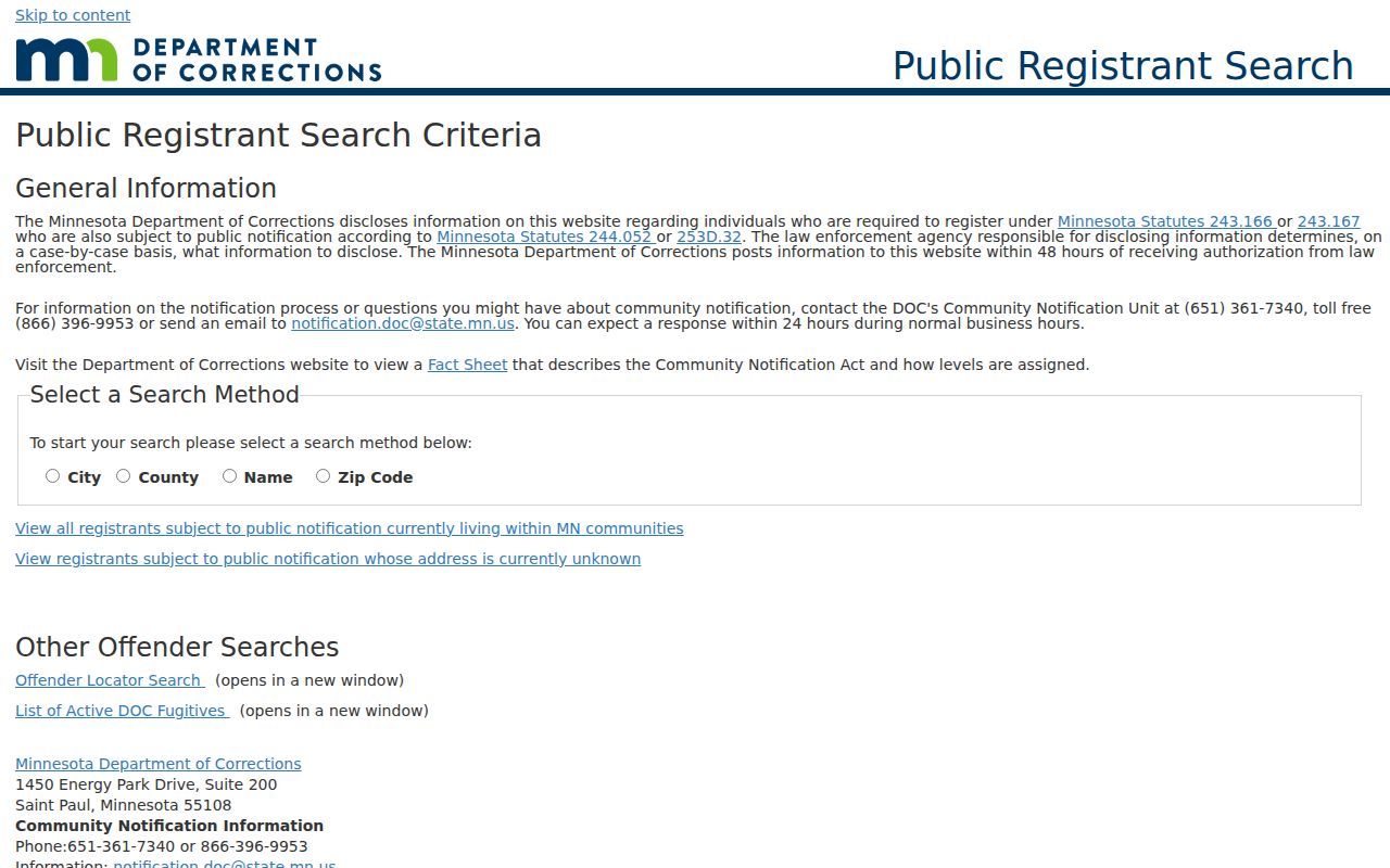
A ZIP field does not change the scope of that state program. Check the current instructions and statutory disclosure rules before relying on any location-filtered result.
West St. Paul ZIP Code City Limits
ZIP geography and municipal jurisdiction answer different questions. West St. Paul is an incorporated Dakota County city, while 55118 is a postal reference that can reach nearby addresses and use Saint Paul as the USPS city label. The City of West St. Paul history explains that the current city incorporated in 1889 after earlier municipal arrangements. That historical identity and the current city boundary should guide jurisdiction research, not a ZIP alone.
- ZIP Code
- A five-digit postal sorting area used to route mail. It is not an incorporated-city boundary.
- ZIP+4
- An added delivery detail that refines the postal address beyond the five-digit ZIP.
- PO-box ZIP
- A ZIP assigned for post-office boxes; it can differ from a street-delivery ZIP and does not identify a parcel.
- Unique ZIP
- A ZIP assigned to a single high-volume addressee or organization; no such West St. Paul ZIP is established by the researched sources.
- Carrier route
- A delivery sequence used for mail handling, not a parcel boundary or an occupancy record.
For a record search, preserve the postal label as one searchable variant and retain the parcel or city authority used to resolve the jurisdiction. That record trail remains useful even when the standardized USPS city and the incorporated-city name do not match.
West St. Paul ZIP Code History Checks
Historical directories and other older records can carry a different city label from a modern postal result. The Saint Paul Public Library city-directory guide documents regional collections and later suburban holdings, while the MNHS Dakota telephone finding aid specifically includes West Saint Paul directories from 1928 onward. Search the dated place label that a record used, then reconcile it with current parcel and boundary information.
No official source located a specific West St. Paul street-renumbering or street-renaming event. Do not infer one from a different postal display or a current map. A claimed transition needs two dated primary or archival sources. The archived parcel sample that displays a PIN pattern is likewise a field example, not a universal current Parcel ID format.
West St. Paul ZIP Code Record Checks
Keep the authority and date beside each answer: USPS for delivery form, Dakota County Property Information for the current parcel, the GIS map for map context, the City of West St. Paul maps page for city geography, and the historical collection for a dated name or address. A mailing address can differ from a parcel’s situs address, which is the physical parcel location. A tax mailing address may point elsewhere and should not be read as a residence claim.
If a public record from a city or county office is needed, use the Minnesota Government Data Practices Act request guidance to ask the responsible authority for an existing record. Identify the record type, date range, parcel or address, and preferred format. The custodian, the statute, and any safety restriction control access. Preserve protected-address and safety-program limits, and do not use public information to stalk, harass, or harm anyone.