
Trace West St. Paul Street Records
A West St. Paul street directory search is a chain of address-keyed records, not a list of everyone on a road. Begin with the delivery address and establish the current parcel. Then preserve the Parcel ID, legal description, map date, and the source for each observation. Those details keep the parcel search, deed index, permit request, and historical address work tied to the same land rather than to a similar street name. A current ownership or parcel entry does not establish every person who lives there, and an older directory entry does not establish a current household.
- Use USPS ZIP Lookup to save the standardized address, unit information when applicable, and the postal city label.
- Search Dakota County Property Information with the address or PID. Enter the building number first, then select the offered address.
- Record the parcel's legal description and inspect nearby parcels in the map. A legal description is the stable land description used in recorded documents.
- Use the description, grantor, grantee, or document type in Dakota County's RecordEASE access route to locate recorded instruments.
- For an address and date in the past, consult the street-name-then-number method in the Saint Paul Public Library house-history guide, then confirm the specific volume and year.
Keep the evidence types separate. The map links a physical location to a parcel. A recorded instrument links parties to a legal interest. A voter confirmation is an individual registration check, while the address indexes and directories are dated publication evidence. That separation makes it easier to notice a moved mailing address, a changed street label, or a name shared by more than one person.
Normalize West St. Paul Street Addresses
Postal and municipal labels should be saved as separate facts. USPS can return Saint Paul as the postal city for ZIP Code 55118 even when the address is in West St. Paul. A ZIP Code establishes delivery geography, not a city boundary and not who occupies a location. Search both West St. Paul and West Saint Paul when a library catalog, historical directory, or finding aid uses the longer spelling. The county parcel map and the city boundary are the stronger tools for a jurisdiction question.
The USPS address form accepts a required street, city, and state, along with an optional company, unit, and ZIP field. If it returns more than one result, provide the unit and retain the standardized form. It is useful for making an address consistent across sources, but it is not occupancy evidence. The city history also warns against collapsing earlier municipal arrangements into the current city. A date can change which government record label is relevant.
Note: No official source located a specific West St. Paul renumbering or street-renaming event, so compare dated directories, plats, and city records before assuming an old number changed.
Search West St. Paul Parcels by Address
Dakota County's Property Watch guide documents the public Property Information search: it uses an address or Parcel ID, accepts a PID with or without dashes, and recommends entering the building number before choosing an address from the suggestion list. The result centers and highlights the parcel, opens property information, shows an aerial view, and can help locate the legal description. The free public map does not provide a robust current owner-name search, so it should not be described as a name-to-parcel directory.
| Property Information control | Type | Use in an address search |
|---|---|---|
| Search Address or Parcel ID | Text and autocomplete | Enter an address or PID; enter the building number first for address searching. |
| Address suggestions | Selection list | Select the offered address rather than relying only on typed text. |
| Map result | Interactive map | Centers and highlights the matching parcel for street-by-street inspection. |
| Property-information panel | Result panel | Shows parcel information and legal-description information for the selected result. |
| Aerial view | Map layer | Adds visual context but does not replace the recorded parcel record. |
The official guide is the source for the workflow illustrated here. Its address-and-PID search screen shows why selecting the suggested address matters before treating a match as the right parcel.
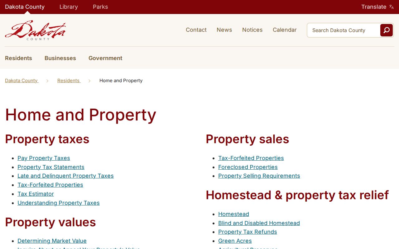
Use the resulting PID and legal description as the bridge to a deed search, not as a claim that the map lists every current resident.
Read West St. Paul Street Maps Carefully
Dakota County Online Property Maps and Interactive GIS Map adds a printable property card, map viewing at different scales, and an advanced GIS option. The county describes roughly 150 layers, including parcels, contours, aerial imagery, parks, trails, road construction, roundabouts, and floodplains. The property-map catalog also offers searches by city, section, grid, address, or PIN, plus map type and download choices. These layers are useful for seeing how parcels line up along a street.
A property map is not a legally recorded map or survey. An official county property-map example says its data were compiled from multiple offices and directs users to the plat or CIC search for lot dimensions. For a boundary or dimension question, compare the current parcel display with the legal description and the appropriate plat materials. Do not infer dimensions from a generalized map view.
- Parcel
- A unit of land represented in county property records and on a parcel map.
- Situs address
- The physical address of a parcel. It can differ from the mailing address used for tax correspondence.
- Plat
- A recorded map of a subdivision or related land division. It is different from a general-purpose GIS display.
- Criss-cross directory
- An address-first directory that can lead from a street and number to a listed household or subscriber for a specific year.
Match West St. Paul Street Records
Different custodians hold different parts of an address trail. Dakota County Property Information is the free current parcel stop. Dakota County Property Taxation & Records keeps recorded land instruments. West St. Paul Community Development uses an address-keyed request form for property and permit history. The Secretary of State's individual lookup checks one registration match, while the controlled voter-list product follows a separate statutory process. The table distinguishes what can be learned from each record without turning a street search into a claim about every household.
| Address-keyed source | Custodian | Evidence offered | Documented access |
|---|---|---|---|
| Property Information and GIS | Dakota County | Parcel geometry, PID, situs address, layers, and legal description | Free address or PID search |
| Tax and property fields | Dakota County | Value, tax, acreage, year-built, and mailing/situs distinction where exposed | Current card or office request; archived examples are not current data |
| Recorded index | Dakota County Property Taxation & Records | Grantor, grantee, instrument date and type, legal description, Abstract or Torrens record | RecordEASE login and fees, or county document-copy route |
| Permit history | West St. Paul Community Development | Address-keyed permit or inspection history, if maintained and releasable | City information request form; no public result database located |
| Voter registration and list products | Minnesota Secretary of State and county elections | Individual match or controlled street-order list product | Individual lookup, or restricted list request under Minn. Stat. § 201.091 |
| Reverse directories | SPPL and MNHS holdings | Historical address to listed occupant or subscriber | Year, volume, and library access vary |
The mailing address on a tax record can point away from the physical parcel, particularly for a nonresident owner. A homestead indicator, if visible in a live property card, is a tax classification or claimed-occupancy clue, not conclusive proof of who is present. Cite a live record with its PID, map date, field date, and source route.
Request West St. Paul Street Permit History
The West St. Paul property-history request form is the documented municipal route for address-keyed permit or property information. It asks for the requestor's first and last name, request date and time, Address1, city, state, ZIP, electronic signature, and a description of the information requested. Address2, phone, email, and an email-copy option are available. The form also uses CAPTCHA. It does not publish a fee or standard processing time, and no public permit-history result search was located.
A good request identifies the address, date range, permit or inspection type, and desired format. That narrows the search without asking the city to assemble a broad person profile. For city-held data outside the form's scope, use the West St. Paul data-request route under the Minnesota Government Data Practices Act, Minn. Stat. ch. 13. A custodian may withhold information that is private, confidential, protected by an active investigation, sealed, expunged, or otherwise restricted.
The official property-history form shows the address, date, request-description, signature, and CAPTCHA fields that should be completed before submitting a narrow records request.
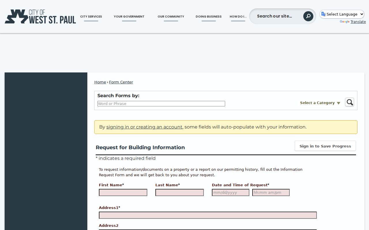
Permit material can establish a building timeline, but it does not create a complete resident list or settle a title question.
Check West St. Paul Street Code Records
West St. Paul Code Enforcement describes a complaint-driven process. Investigation information is protected while an investigation is active; selected material can become public after closure, compliance, or citation. No public city database for searching code cases by address was identified in the research. The practical route is a focused request after the record has been classified, with the street address, approximate date, and type of matter clearly stated.
The city procedure is useful because it separates a closed or cited matter from an open investigation. It should not be treated as a neighborhood roster or a way to infer private facts about an address. Ask for the record category and release status first, then let the custodian apply the applicable data-practices classification.
The city code-enforcement procedure illustrates the complaint, investigation, notice, compliance, and closure sequence that governs whether an address record may be releasable.
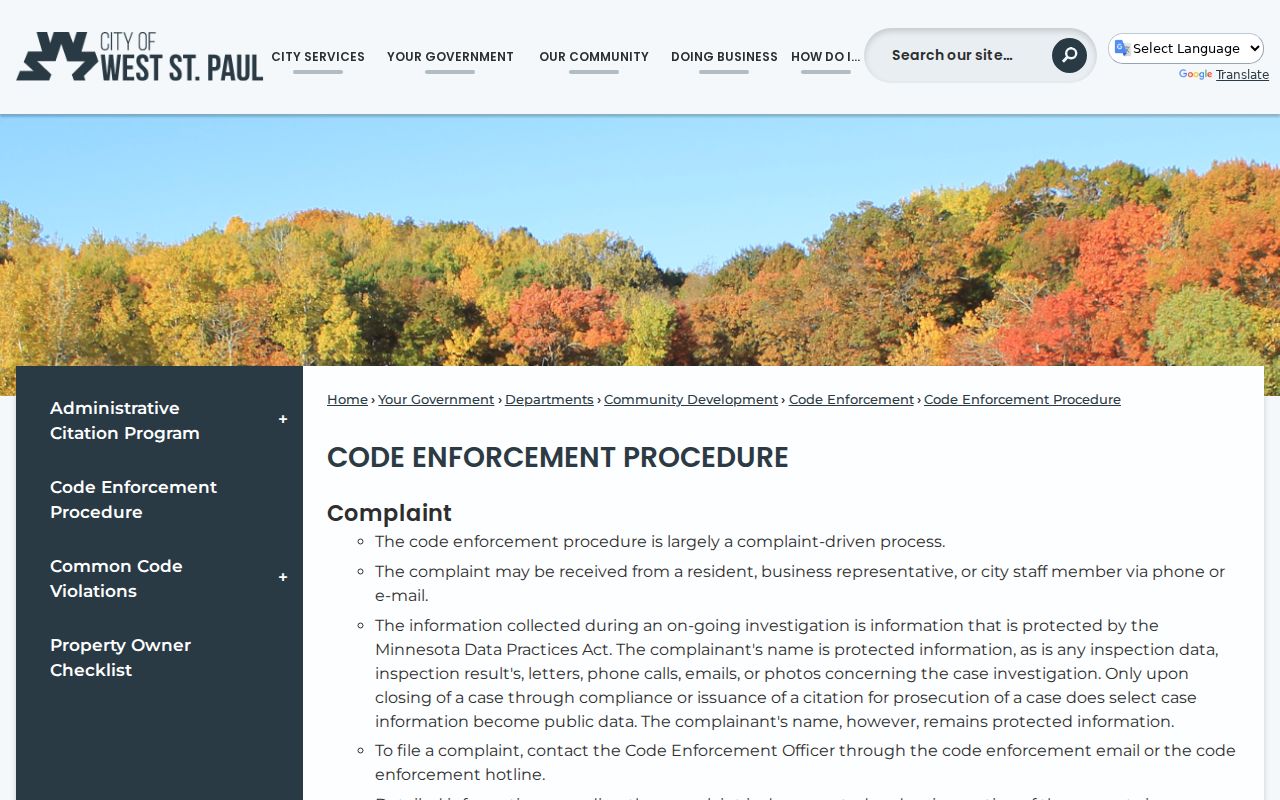
Use a code record as a dated municipal process record, and retain its status and source date with the address notes.
Keep West St. Paul Street Voter Records Limited
The Minnesota Secretary of State voter-registration lookup is an individual confirmation tool. It requires first name, last name, birthday, and address details. On the address path, the form requires ZIP Code, county, city or township, house number, and a street selected from the offered list; a unit becomes required when the unit option is selected. The result can confirm a registration match and provide status information. It is not a downloadable directory of West St. Paul residents.
A Walking List is a different product. Under Minn. Stat. § 201.091, it may be organized by street and house number, but it requires registered-Minnesota-voter certification, payment, and a permitted election, political, or law-enforcement use. It cannot be posted online as a searchable list or used for unrelated purposes. The county and state, rather than a free street search, control that access channel.
Note: Registration data is updated nightly, but newly processed applications may take time to appear and should be confirmed through the election office when a mismatch remains.
Compare West St. Paul Street Maps and Deeds
For a West St. Paul street directory search, Dakota County Property Information and RecordEASE serve different purposes. The GIS is free and keyed to an address or PID. RecordEASE is a login-gated, fee-based land-record service with searches by legal description, grantor, grantee, and document type. It can provide TIFF images and PDF or paper printing. The county says its abstract computer index is online back to July 8, 1993, while digitized Abstract and Torrens documents are available within the county's stated book, page, and document ranges.
RecordEASE's current search form is behind login, so the documented search modes come from the county's official access page. Occasional access is listed at $5 per session, $1 per search, and $2 per document. Subscribers pay a monthly amount with lower per-item charges. When the portal is not appropriate, Dakota County's document-copy service says deed copies can be provided free, with service in Hastings, the Northern Service Center in West St. Paul, or the Western Service Center in Apple Valley. Written requests can also be mailed to Hastings, Attn. Research, with cash or check; the county asks users to allow 24 hours for mailed requests.
A deed grantee is a party receiving a recorded legal interest. That fact is not proof that the person occupied the parcel continuously, so it must be compared with dated directory, census, newspaper, or other permitted evidence.
Use the 1929 West St. Paul Street Index
The SPPL house-history guide identifies a practical former-household route: beginning in 1929, use the street name and then the house number in the directory index. Check the alphabetical entry after finding a potential name. The directory conventions changed over time. House numbers appear in the 1885 directory; the 1929 material notes a homeowner dot, wives' names, and a street index; 1933 expands to all adults; later volumes add telephone markers and telephone-number sections. A symbol is a publication convention, not a title record.
The MNHS Dakota County telephone-directory finding aid is especially useful because it includes West Saint Paul volumes, dates from 1928 forward, and describes 1,237 volumes with 226 microfiche. It is open for research, but the city, year, and shelf should be confirmed before requesting a scan or visit. The broader historical collections are available through West St. Paul city directory resources; use them for the specific dated volume instead of assuming every St. Paul directory covers the suburb.
Directory evidence can omit minors, transient people, people not listed as household heads, and addresses outside a particular publication's coverage. It is a dated lead, not a complete household census.
Separate West St. Paul Streets from Postal Labels
A West St. Paul address can have a Saint Paul postal label for ZIP Code 55118. That is a useful search quirk, especially in directory and postal tools, but it does not move the parcel across the city boundary. The official city maps and Dakota County GIS are the appropriate jurisdiction checks. City and postal names should be recorded side by side when an address result uses different wording than an historical volume or a county map.
The same care is needed for historical government labels. The current city formed in 1889 after earlier municipal arrangements, so a record's date may call for a different place description. Search terms should be tied to the source and time period rather than silently modernized. This avoids treating a postal city, a present-day municipal boundary, and a historical record label as the same thing.
Respect West St. Paul Street Directory Limits
A street directory cannot show every person connected to an address. People absent from parcel, deed, and dated-directory records may not appear in the public trail. Utility customer information is not a public city lookup, and motor-vehicle address data is restricted by the federal Driver's Privacy Protection Act. Court, city, and vital records can also have private, confidential, sealed, expunged, or otherwise restricted fields. Safe at Home participants and voters using a safety procedure need particular care.
Lawful use. West St. Paul address records support personal, lawful property and family-history research. Do not use an address, substitute address, or restricted field to stalk, harass, intimidate, or harm another person.
When a source conflicts, cite it as it stands, including the date and access limits, instead of forcing the records into one story. The Minnesota Government Data Practices Act, Minn. Stat. ch. 13, presumes public access only where data have not been classified otherwise. Custodian confirmation is the proper final check for an uncertain record.